Surveying, Inspection Drones Can Help Cut Costs During Oil, Gas Bust
With drone technology rising and the oil and gas industry experiencing a downturn, solution providers are working to lower drilling industry costs through drone integration. Source: GE
Drones have already been proven to mitigate safety hazards, shorten mapping and detection time, and lower operation costs at oil and gas sites. Source: Identified Technologies
GE is testing the use of drones for methane leak detection, while Identified Technologies is offering an end-to-end drone solution for site mapping. Source: Identified Technologies
John Westerheide says that a downturn is a perfect time for innovation because operators are more open than ever to technology that will lower the cost and increase the rate of production. Source: Identified Technologies
The oil and gas drilling industry is in the midst of what many consider a devastating bust tied to increased production and lower prices per barrel. At the same time, a completely separate industry, the unmanned aircraft systems (UAS) or “drone” industry, is on the rise with the help of new Federal Aviation Administration (FAA) rules on commercial use of small UAS that became effective in August.
As unrelated as the industries may seem at first glance, the simultaneity of the oil and gas bust and the drone boom has created a perfect storm for integrating the two; that is finding a place for drones in the world of drilling. From research and development to commercially available solutions, drones are already being tested in and utilized for drilling applications. Drone solution providers say the technology promises to save time, increase safety and cut costs for oil and gas stakeholders in particular.
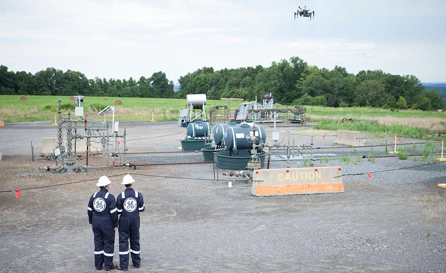
GE is in the midst of a research and development project unofficially named Project Raven, which has tested the ability of a drone to detect methane leaks at oil and gas sites. Contrary to popular belief, the downturn is a great time to pursue such a project, says John Westerheide, technology leader and program manager for the oilfield facilities and systems team at GE Global Research’s Oil and Gas Technology Center.
“Our customers need to drive profitability and productivity within their operations. If we’re able to put tools in their hands that allow them to do something faster, at less cost, with better understanding and results than they’re currently doing today, that ultimately leads to better profitability and productivity for them,” Westerheide says. “We see this technology really helping to drive those results that are going to allow the industry to thrive even in a lower priced environment.”
A set of FAA regulations specific to drones for business purposes that makes the process of legally operating them easier by, for example, eliminating the requirement of a traditional aircraft pilot license only helps, he says.
Project Raven
Project Raven, an ongoing venture, was initially conceptualized on the back of a napkin in the summer of 2015, Westerheide says. The project is powered by GE’s new Oil and Gas Technology Center, located in Oklahoma City, Okla., which specializes in advanced technology development and applications into oil and gas operations. By December, a rough proof of concept was being conducted to determine if identifying methane concentration in oil and gas sites by way of drone was even possible. In July 2016, in-field demonstrations with real flights over real assets were accomplished.
Because a drone is able to easily fly between assets, an operator can stay at a single location and inspect many assets in the same geographical area at once.
In a broad sense, GE is increasing its focus on inspection as a service via robotics, with drones being the aerial form of the robotics. The end goal is to augment and reduce the need for human labor in the typical inspection process. Westerheide points to the drilling rig as an example. Often times, he says, conducting an inspection on a rig the traditional way requires working considerably high above ground. Project Raven is examining how autonomous drone technology can be used to do the same inspection a human would do, but removing them from at-height work applications, greatly diminishing inspection-related safety hazards.
Another example Westerheide highlights addresses productivity as well as safety. Because a drone is able to easily fly between assets, an operator can stay at a single location and inspect many assets in the same geographical area at once. This decreases the number of miles driven by the person operating the robot. Fewer miles driven not only means less likelihood of potential accidents on the road, it also reduces the time required to inspect numerous sites.
The time saved varies based on the type of inspection application being performed, but based on methane leak detection testing conducted so far, Westerheide says his team has identified at least a 55 percent decrease in time to inspect a well site. And that is just the actual inspection time. He explains that tied to the inspection time is the analysis time, which is traditionally handled back at the headquarters; this step involves taking the information obtained onsite and turning it into useful insight. With the user interface developed as a part of Project Raven, operators are able to produce a report as soon as the mission is over.
“You don’t require that back-at-the-shop analysis in reporting that could take an additional amount of time. So we’re eliminating the back end work required and reducing the time to inspect for this particular application by more than half,” Westerheide says.
Together, less time and fewer safety hazards mean less money spent.
Site Detection through Drone Data Collection
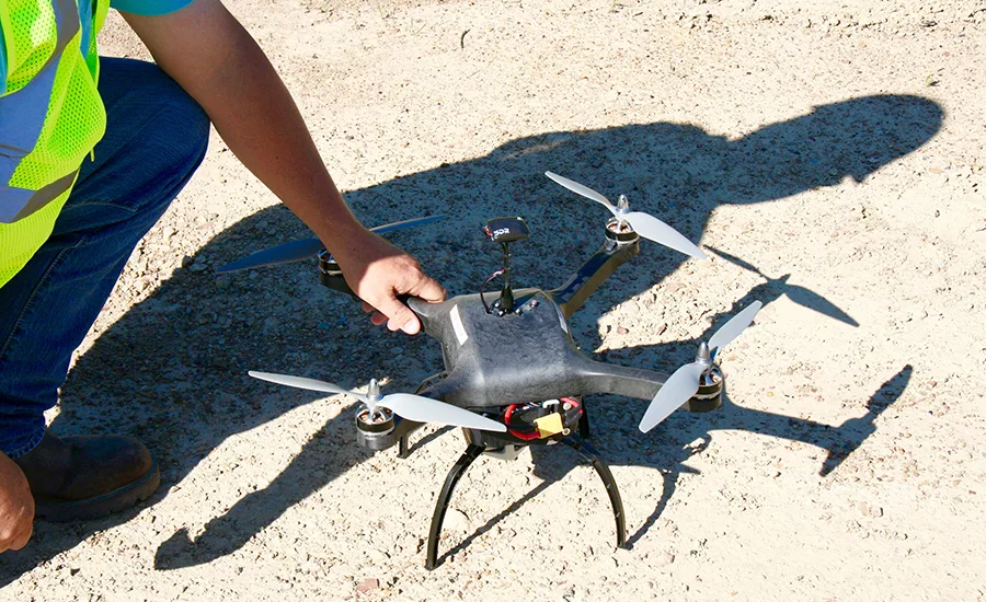
There are four key parts to Project Raven, a pre-commercial research and development platform: the drone called Raven, the sensors, the ground control station and the back end.
The helicopter drone, developed by GE and Oklahoma State University’s aerospace program, is on the smaller side, Westerheide explains. He says it started as something you’d see at a hobbyist store and has increased to around the size of a breakfast table. Attached to the drone are specialized lasers that are responsible for actually sensing the methane leaks as the drone flies over a site. Westerheide thinks of this as the mobile front end, all about inspection.
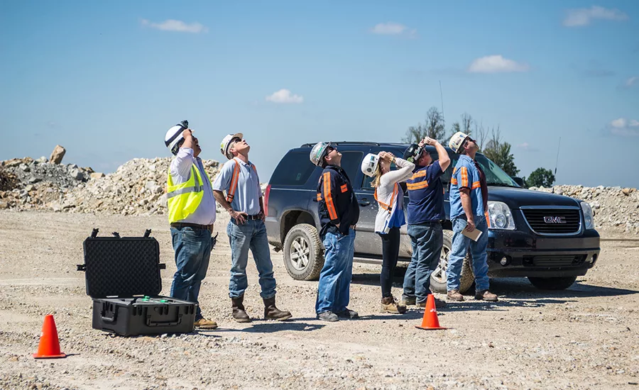
Then there is the middle part, the ground control station, which acts as the link between the operator controlling the mission and the drone itself. It sends information to the drone about where to fly and what data to collect. Then it collects the information obtained by the drone and feeds it to the operator. Westerheide thinks of this as the analytics and telecommunications middle man. The ground control station looks something like a ruggedized suitcase. Inside there is computational capability for running analytics in the field as well as telecommunications and modems for transferring information, wherever the user may be in the world.
Finally, there is the back end, the actual user interface and what the user sees. It takes the form of a mobile app accessed by an iPad with cloud-based analytic capabilities. It provides a common way to interpret the information that comes in real time, as well as plan missions, which involves dictating where to fly, when to fly, etc.
The information entered into the iPad, such as flight path and mission planning, is sent to the ground station. The ground station then uploads the information to the drone, the drone runs the mission and, as it collects the information, the drone feeds the information back to the ground station, which subsequently conducts analytics and relays the data back to the user interface, the iPad.
The end product is a concentration-based heat map overlaid on a satellite image, or a geographic information system (GIS) based image, that shows the geospatial concentration of methane across an asset, or the flight path of the drone itself. The translation of point-by-point concentration data into a heat map allows the user to identify hot spots, which are likely areas of leakage.
Within the map, lower concentrations are represented as cooler colors and higher concentrations are represented as warmer colors. For example, a low background concentration that indicates a normal operation may be a green or a blue. A higher concentration that may indicate a leak would be a red or an orange. The drone also collects 4K video footage, another sensor modality being collected and fed into the common digital back end in real time and in high definition.
“This project in particular is very exciting,” Westerheide says. “We’re essentially industrializing and simplifying advanced UAV technology so that it can be adopted by anyone, regardless of background in the oil and gas industry.”
Boomerang
GE isn’t the only entity embracing drones for the drilling industry. Identified Technologies, headquartered in Pittsburgh, is introducing drones to oil and gas sites as well and its solution is already commercially available. The company, which offers end-to-end Drone as a Service (eeDaaS ) for the wider construction industry, has been in business for just over a year and, if drilling sector demand is any indication of the value of drone s for drilling, the future looks bright.
“It’s been an awesome year. By most definitions we’ve grown more than 500 percent in the last year,” says Dick Zhang, Identified Technologies founder and CEO. “Reception has been awesome. We’ve started with clients in midstream that have sister companies in the upstream business, so we’ve grown from just one to three or four clients that all stemmed from one initial relationship.”
The company offers a subscription-based model, which includes its drone, named the Boomerang, sensors mounted on the drone and proprietary software, Site IQ.
“As part of onboarding with new clients, we will get them FAA certified and ready, what we call Boomerang certified. … Then our clients themselves, on the sites themselves, will get that Boomerang in the air and capture all the data.”
Like the Project Raven, Identified Technologies offers an end-to-end solution. The drone flies over an oil and gas site, the sensors take pictures, and Site IQ turns the images into 2D maps and 3D models. Site IQ also has an analytics reporting function that takes all of the information and starts to track productivity on sites.
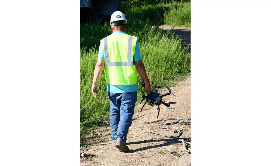
The Boomerang is a copter design with four propellers. It is about 1 foot-by-1 foot-by-8 inches and weighs about five pounds. It can reach the FAA small UAS altitude limit of 400 feet without a problem, Zhang says. It can usually fly on the order of 12 to 15 miles in one pass. If mapping is being conducted on a rectangular kind of site, around 100 to 150 acres can usually be covered. It takes about 15 minutes to capture data on 100 acres worth of land.
Ease of Use
The drone mapping solution has been built with ease of use in mind. Zhang says it is designed so that anyone with zero knowledge of how to fly and zero knowledge of aviation can use it. An iPad controls the drone operation.
“On the iPad, on what looks like Google Earth, with your finger, you draw a circle around your site. You just tell the drone what the boundaries of your site are and then it figures out a flight plan, how high, how fast, when to take pictures, all of that by itself. So it’s all done automatically, so you basically hit a button, it takes off, does its work, comes back and you’re done,” he says.
Surveying and mapping is a part of every major oil and gas site, from construction to maintenance, whether it is a pad or a pipeline Zhang says. Operators traditionally go through a lot of trouble to capture quality survey data, whether they send a surveyor out to do it on the ground or have an airplane handle it. The former can make for lower quality results and the latter, while it offers quality data, is very expensive, Zhang says.
“So the power of having this Boomerang in the back of your truck, you now have your own fleet of aircraft for like one thousandth of the price,” he says.
On the construction side, the Boomerang has been used for prepping pads and pipelines. The resulting 3D models of the site make it easier to track construction and compare actual construction progress to the initial plan. Another common Boomerang use case involves tracking infrastructure post construction. When wells are drilled and piping is constructed, documenting their location is important. So, for example, once a pipe has been completed, right before earth is dumped back over it, the Boomerang, along with its corresponding hardware and software, makes mapping it and documenting it easier than ever.
The finalization of the FAA’s rule has greatly reduced the barrier to start using drone technology in general, which is great for the drilling industry and great for a business like Identified Technologies that serves the industry, Zhang says.
“Prior to this rule, you had to spend about 30 hours physically in an airplane and then do another couple dozen hours testing and studying on physical airplanes, which was very silly because there’s a very different skill set from flying a [plane] than there is flying a drone or watching it fly itself. So now the rules are, if you pass this test — it’s a paper test, 60 questions — you’re good to fly drones for two years.”
Future
Next, Zhang plans to expand to applications including methane leak detection, like GE. Both entities are looking at thermal technology as a future endeavor, which is tied to a greater goal of continuing to implement different kinds of sensors that will open the door to more potential applications.
“There’s no doubt going to be additional sensors,” Westerheide says. “We’re trying to leverage, as much as we can, an understanding of common sensor capabilities that are required, not only within oil and gas, but with other industries like transportation or the power sector. Then what we’re doing is we’re tailoring the reporting, the digital back end and the analysis tools to the specific use cases within the oilfield. So common sensors, but specialized applications within the digital back end.”
He eventually sees drone technology being implemented in use cases that replace or augment drilling operators in pickup trucks with robotic technology. He highlights the concept of the “great crew change” describing it as a drilling industry with less of a work force and more things to do.
“These types of technologies allow operators and our customers to be able to do more with less from a human resources standpoint, so it’s good timing for that as well.”
How disruptive drone technology will be for drilling is something only time will tell. With a perfect storm of a drone boom and a drilling bust, and evidence of increased value for site construction and maintenance, the phenomena shows no signs of slowing any time soon.
Looking for a reprint of this article?
From high-res PDFs to custom plaques, order your copy today!


